The Kjerag trail, stage by stage
Stage one: the car park and the service building
You start at Øygardstøl, at the top of the twenty-seven hairpin bends above Lysebotn, known in English as the Eagle's Nest. There is a service building with toilets and, in season, a staffed tourist information desk. There is a map on the wall in there. I pointed at it for eleven summers and my advice has not changed: look at the profile rather than the distance, because the distance is the least interesting number on that map.
Parking is paid and the car park is large. Use the toilets here, because this is the last of them. Fill your water. Look up at the plateau, and if it is sitting under a cap of fog while you are standing in sunshine, take that seriously, because you are going up into it: where the trail starts.
Stage two: the first climb, and the first chains
The trail goes up almost immediately, and it goes up steeply. This is the section that tells most people what kind of day they are having. Bare rock, sloping, with chains bolted along the worst of it. Use them properly: hand over hand, weight on your feet, chain as a handrail rather than a rope to haul on.
The first climb is also the natural turning-back point, and a fair number of people take it every summer. If this section has already emptied you, the honest thing to do is go back and have a good afternoon. Nothing beyond here gets easier, and everything beyond here has to be walked twice: the chains page.
Stage three: down into Litle Stordal
Here is the part that surprises people who read the elevation figure and pictured one hill. The trail tops out and then drops, losing a good chunk of what you just gained, into the first of the two dips and the one that carries a name: Litle Stordal. Coming down is pleasant and quick on the way out. Remember that it is a climb on the way back, when you will be far less pleased about it.
This is the point at which to do the honest arithmetic. If the first climb and this descent took you much longer than you expected, the whole day will scale accordingly, and the boulder is still two climbs away: the timings page.
Stage four: the second climb
Up again, on the same kind of ground, with chains where the slab steepens. The second climb is where a party finds its real pace. The adrenaline of the start has gone, the novelty of the chains has gone, and what is left is steady work on rock. People who are going to have a comfortable day settle into it here. People who are going to have a hard one start stopping more often.
Stage five: the second descent
Down into the second dip. By now you have given back height twice and gained it twice, which is the whole point of the phrase three ascents and two descents. It is also why the published time runs from six hours to ten: the profile rewards a steady party and punishes a fast start.
Stage six: the third climb, onto the plateau
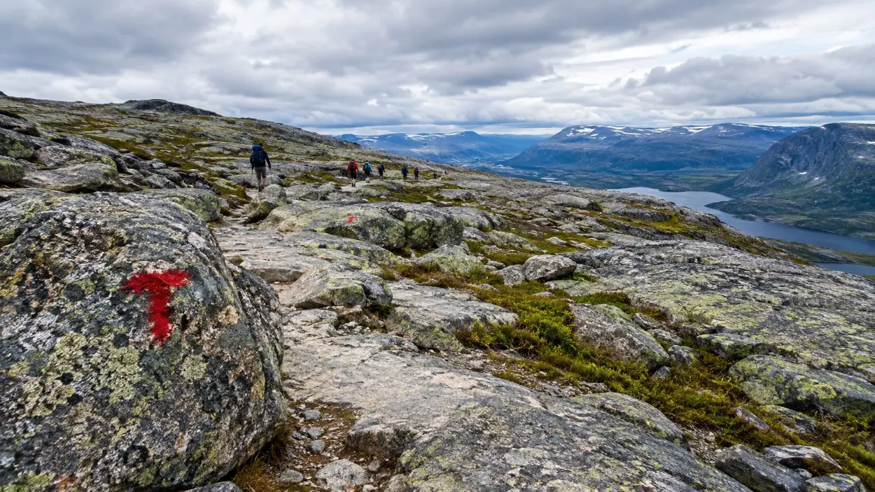
The last climb puts you onto the Kjerag plateau, and the ground changes character. The steepness ends and you come out onto broad bare rock, pale and scoured, with the Lysefjord opening below on one side. The highest point of the mountain is around 1,084 metres above sea level, the highest point on the fjord.
This is also where the weather stops being theoretical. The plateau is exposed, the wind comes up the fjord side, and fog settles here while the car park sits in sunshine. In clear conditions the walking is easy and lovely. In cloud it is featureless, and the difference between those two experiences is larger than anything else on this trail: weather and rain.
Stage seven: out to the boulder
Flat, easy walking across the plateau to the crevice. Kjeragbolten is about five cubic metres of rock wedged in the gap with 984 metres of air below it, left by the ice around fifty thousand years ago and jammed there when the land rebounded faster than the sea rose. You step onto it from the side, roughly half a metre, onto a flat top, with rock on both sides.
On an August afternoon there is a queue, and standing in the wind waiting your turn is a different experience from walking straight out onto it at nine in the morning. The boulder itself takes a couple of minutes. The photograph takes longer than the stride does: the boulder page and how to miss the crowds.
Stage eight: the way back, which is the real test
Everything in reverse, and it is not the same walk. Two climbs and three descents on legs that have already done the day, on rock that may well have had a shower on it while you were at the top. This is where the injuries happen at Kjerag: broken bones, turned ankles, bad landings on wet slab. Not at the boulder. Here, in the afternoon, on ground that felt easy in the morning: the safety page.
Included
- Bare rock underfoot for most of the route
- Several hundred metres of chains on the steep slabs
- Three ascents and two descents in each direction
- Toilets and, in season, an information desk at the trailhead
- A flat, easy plateau walk at the far end
Not included
- Any shelter along the route
- Drinking water beyond what you carry
- Steps, handrails or a built path
- Lighting of any kind
- The chains, outside the road season, because they are taken down
Walk the first descent as if you have to climb it later, because you do. The most common mistake I saw was people trotting down into the dip to save time and then finding that they had spent the legs they needed for the third climb.
What the surface does
This is not a path in the usual sense. It is slab: broad, sloping, bare rock with cairns and paint marking a line across it. Dry, it grips well and the walking is a pleasure. Damp, it becomes a different material and the chains stop being optional. Western Norway being what it is, assume damp and be pleased when you are wrong. Footwear matters more here than on any comparable Norwegian walk: what to wear.
The trail without the chains
When Fv500 closes for the winter the chains are removed and put back when it opens again. That turns the route described above into something else entirely: the same slabs, the same three climbs, no handholds, snow over the marks, and a requirement for winter equipment and a guide. Do not read this page as a description of a February day: the season page.
Walking it with somebody who knows it
The guided day out of Stavanger covers the road at both ends and about five and a half hours on the mountain, which is the fast end of the range and a useful thing to know about yourself before you book.
A word about what that widget books. It books the ride out of Stavanger and, on most of these, a guide. It does not book Kjerag. Nobody sells a ticket to the trail: it is free, open and unguided, and anyone who gets themselves to the top of the road can walk up it without paying a soul.
Frequently asked questions
How many climbs are there on the Kjerag hike?
Three ascents and two descents each way, totalling around 760 to 800 metres of climbing: how hard it is.
What is Litle Stordal?
The named dip on the route, between climbs, where the trail gives back height you have already gained: the timings.
Are the chains necessary?
On the steep slabs, yes, especially when the rock is wet. They are removed when the road closes for winter: the chains page.
Is the trail hard to follow?
Not in clear weather. In fog the plateau is featureless bare rock: weather and rain.